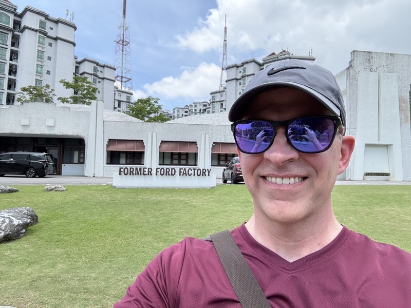
About a year ago I visited the Former Ford Factory in Singapore. The building is an unlikely piece of history: completed in 1941 as Ford Motor Company's first automobile assembly plant in Southeast Asia, it served that purpose for less than a year before becoming the site where Lieutenant-General Arthur Percival signed the British surrender to General Tomoyuki Yamashita on February 15, 1942. It is now a museum and national archive, and the exhibits trace the arc from prewar Singapore through the Japanese occupation and into the postwar period. I went because I was in Singapore for other reasons and thought it would be interesting. I stayed for hours. What I found there has shaped how I think about strategic narrative and self-deception in ways I did not expect.
The British had spent decades building Singapore as the linchpin of their Far Eastern strategy. They called it the "Gibraltar of the East," and the phrase was not idle rhetoric. It shaped force structure, deployment planning, naval doctrine, and the assumptions underlying the entire defense of Malaya. Singapore was supposed to be the fortress from which the Royal Navy would project power across the Indian Ocean and the South China Sea. The strategy assumed that the fleet would be available, that the fortress would hold long enough for reinforcements to arrive, and that no adversary could approach through the dense jungle of the Malay Peninsula. Each of these assumptions proved wrong.
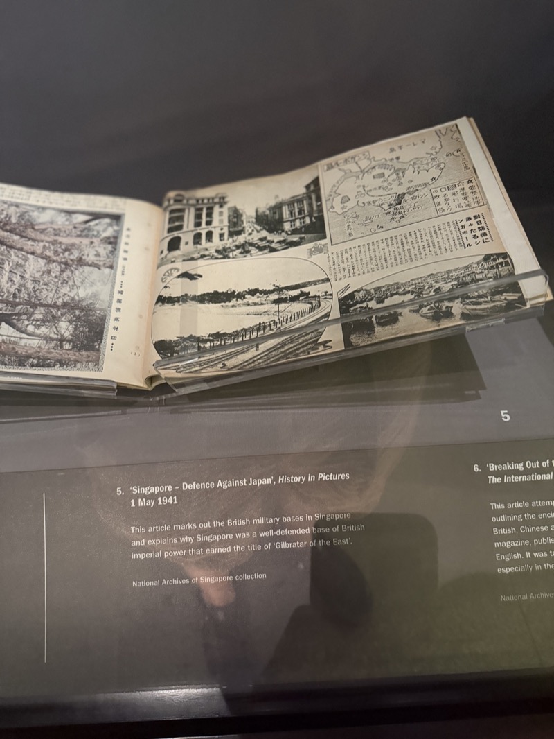
When Japan attacked in December 1941, the British sent HMS Prince of Wales and HMS Repulse north without air cover, on the theory that capital ships could operate independently against air attack. These were not minor vessels. The Prince of Wales was one of the newest battleships in the Royal Navy, the ship on which Churchill and Roosevelt had signed the Atlantic Charter just months earlier. Both were sunk on December 10, three days after Pearl Harbor, by Japanese torpedo bombers operating from bases in Indochina. It was the first time in naval history that capital ships underway at sea had been sunk solely by air power. The museum displays a Japanese publication from May 1941, months before the war began, that already mocked the "Gibraltar of the East" conceit. Japanese intelligence had studied British dispositions with care, mapped the coastal batteries, identified the gap in air defenses, and planned their approach through the supposedly impassable jungle. The British appear to have believed their own slogans.
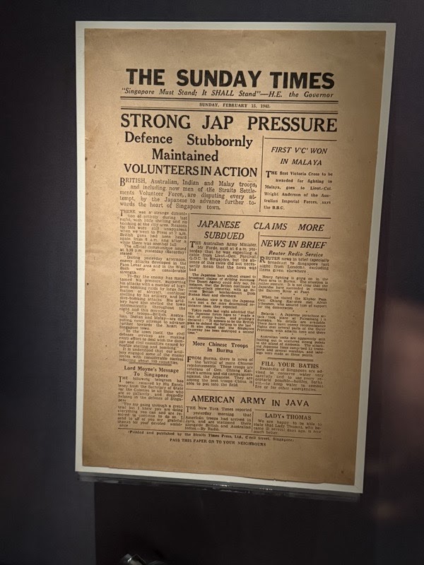
The press coverage in the final days before the surrender is the exhibit that stayed with me longest. The museum displays front pages from the Straits Times and Sunday Times published on February 13 and 15, 1942. The headlines read "Japanese Suffer Huge Casualties in Singapore" and "Strong Jap Pressure, Defence Stubbornly Maintained." These were not deliberate lies in the conventional sense. The evidence suggests that the information environment had become so distorted that the people producing and consuming these newspapers genuinely did not understand how close the end was. The museum caption notes that despite the gallant tone, the Japanese already controlled Singapore's reservoirs, and Percival and Governor Thomas were privately discussing surrender.
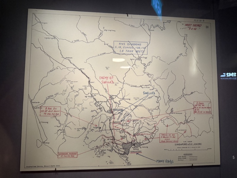
Alongside these newspapers, the museum displays a "MOST SECRET" British military map of Singapore and southeast Johore. The map shows the actual disposition of forces: unit positions, Japanese divisions, shelling zones. It is honest in the way that classified documents tend to be, because the people who use them need to make real decisions. The gap between the map and the headlines is the exhibit's quiet argument. The map shows a defense in extremis. The newspapers describe stubbornness and Japanese losses. Percival was somewhere in between, reading both, unable to reconcile what the press was telling the public with what his staff was telling him. When leaders build a narrative about their own strategic position and then encounter evidence that contradicts it, the tendency is to adjust the evidence rather than the narrative. The fortress had to be holding, because "Fortress Singapore" was the strategy. Yamashita's forces moved through the Malay Peninsula in 55 days.
The speed of it is worth pausing on. The Japanese used a tactic called kirimomi sakusen, a driving charge that bypassed strongpoints and kept the defenders perpetually off balance. The British had trained and positioned their forces to defend fixed points along roads and coastlines. The Japanese came through the jungle on bicycles and lightweight vehicles, outflanking one position after another. The gap between the war the British expected to fight and the war that actually came was the gap between the narrative and the reality. The "Gibraltar of the East" was a story the British had told themselves for so long that it had calcified into doctrine, and when doctrine met a different adversary with a different approach, doctrine shattered.

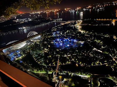
I think about this pattern when I read about present-day strategic planning in the Pacific. The language is different, the technology is vastly more sophisticated, and the actors have changed. But the underlying risk is the same: that the people making the decisions start believing their own slogans, that narrative confidence substitutes for operational reality, and that the gap between the two only becomes visible when it is too late to close it. The Former Ford Factory is a quiet building on a quiet road in the Bukit Timah neighborhood of Singapore. It does not announce itself. But what it shows, for those who spend the time, is how a great power can talk itself into catastrophe.